
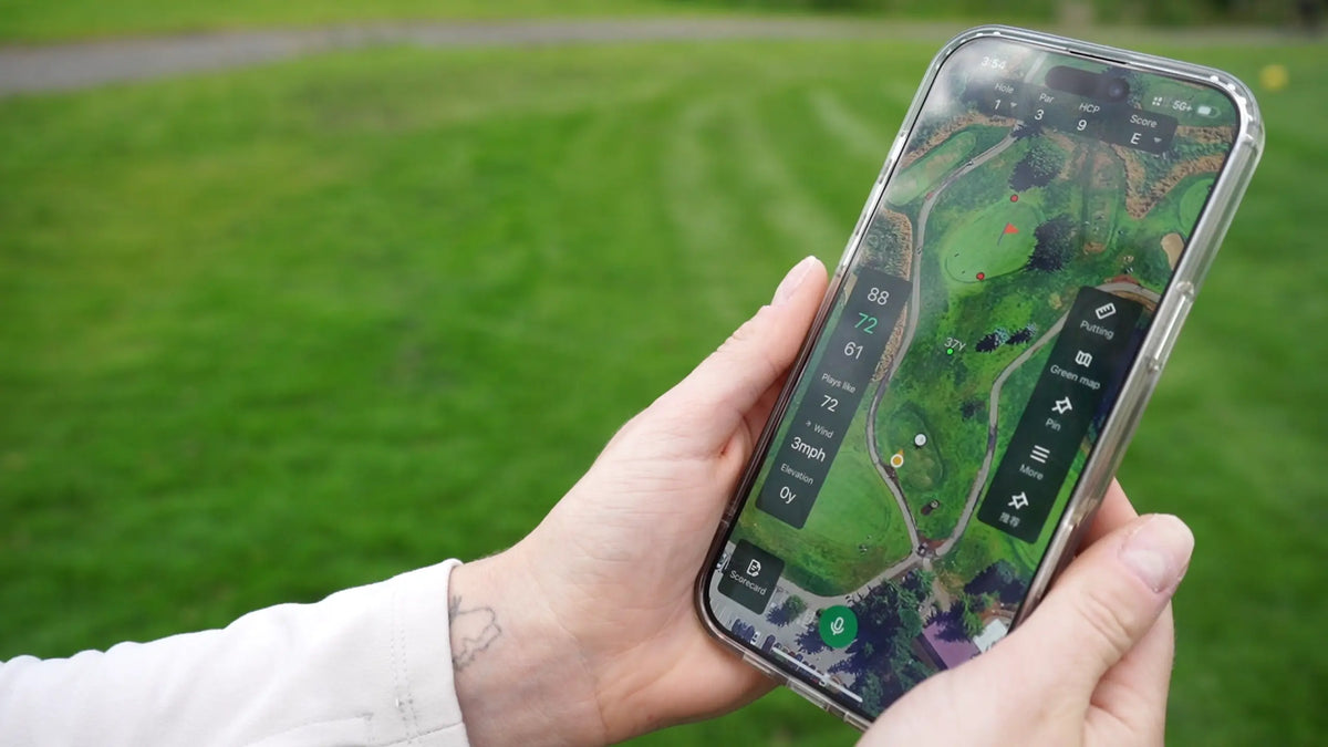
Open a golf green map for the first time and you may see an outline filled with contour lines, arrows, colors, or slope percentages. The map contains useful information, but it is not always obvious where to begin.
A green map can help in two different points during a hole. Before an approach, it can reveal the depth, tiers, ridges, and falloffs that shape the landing area. Once the ball is on the green, it can provide a broader view of the slope between the ball and the hole.
The map becomes easier to use once you know how it is oriented and what its symbols mean.
What Is a Golf Green Map?
A golf green map shows the shape and elevation changes of a putting surface. Contour lines connect areas of equal elevation, arrows usually point downhill, and colors or percentages may indicate slope severity. To read one, orient the green, check the legend, identify the main high and low areas, and then locate the pin and ball.
How to Read a Golf Green Map
A useful read begins with the overall shape of the green. The smaller details make more sense after the map has been properly oriented.
Orient the Green
Find the front, middle, and back of the green, then confirm the direction from which the hole is being played. Some digital maps remain in a fixed position, while others rotate based on the golfer's location.
The top of the screen does not always represent the back of the green.
Check the Legend
The legend explains what the colors, arrows, lines, and numbers mean on that specific map. One platform may use color to show elevation, while another uses it to show slope severity.
If the map includes numbers, check whether they represent slope percentage, degrees, elevation, or another measurement.
Find the Main High and Low Areas
Look for the broad shape before studying individual lines. A raised tier, central ridge, false front, or steep falloff may matter more than a small change near the edge.
This first look should reveal which sections sit higher and where the surface generally falls.
Locate the Pin and Ball
If the map supports a movable pin, make sure the hole location has been set correctly. For an approach shot, compare the pin with the available green depth and surrounding landing area.
Before a putt, place the ball and hole in their approximate locations and look at the overall elevation change between them. The map provides a starting point. The final read still comes from the green itself.
What the Symbols on a Green Map Usually Mean
Green maps do not all use the same design language. However, most rely on some combination of contour lines, arrows, colors, and slope measurements.
Contour Lines
Contour lines connect points at the same or a similar elevation. They show how the surface rises and falls without requiring a three-dimensional view.
Lines that sit close together usually indicate that elevation changes over a shorter distance. Lines spaced farther apart usually suggest a more gradual change. The meaning can still depend on the scale and detail of the map.
Contour lines are useful for identifying tiers, ridges, and larger slopes. They do not tell the golfer how hard to hit the putt.
Directional Arrows
Arrows commonly point downhill or show the direction water would flow across the surface. On some maps, larger, darker, or more closely spaced arrows may indicate a stronger slope.
Those details are not standardized. The legend should explain whether arrow size, color, density, or movement represents slope severity.
An arrow also does not show the exact path the ball will follow. The final roll depends on the ball's starting position, direction, and speed.
Color Gradients and Slope Percentages
Color may show relative elevation or the steepness of different sections. A map might use warmer colors for stronger slopes and cooler colors for flatter areas, but another platform may use a different system.
Red does not always mean high or steep. Blue does not always mean low or flat.
Slope percentages provide a numerical view of the surface. A higher percentage generally represents a more noticeable slope, but it does not translate directly into a specific amount of break or a fixed aiming point.
How to Use a Golf Green Map During a Round
Before an Approach Shot
A green map can be useful before the ball reaches the putting surface.
Start with green depth. A green that measures 35 yards from front to back offers a different club-selection picture from one that is only 22 yards deep. The pin position then helps show how much space is available short, long, left, and right.
Tiers can be equally important. A pin on a raised back section may require enough carry to reach that level. A false front can return a slightly short approach to the fairway or collection area. An upslope behind the pin may help contain a slightly long approach, while a falloff can make the same miss more costly.
The map can also help you choose a target that fits the available landing area rather than treating the flag as the only option.
If one side leaves a difficult recovery and the other offers more green, the wider section may provide a more practical safe miss.
Before a Putt
Once your ball is on the green, the map serves a different purpose.
Locate the ball and hole as closely as the map allows. Then look at their overall high-low relationship. The putt may climb, fall, cross a side slope, or pass over a ridge before reaching the cup.
The map can reveal the larger movement that is difficult to see from one position. It may also help explain why a putt that appears straight from behind the ball moves near the hole.
Check the slope around the ball, through the middle of the putt, and near the cup. Those local details may not be visible on a broader map.
Speed remains part of the read. A firmer putt usually takes less break, while a slower putt has more time to move with the slope. That connection is especially important for golfers who regularly leave putts short.
A green map provides context for the line. It cannot supply the intended pace.

What a Green Map Cannot Tell You
A green map describes the surface that was mapped. It does not know exactly how the green is playing today.
Moisture, dew, grass growth, maintenance, and foot traffic can change the speed and smoothness of the surface. Grain may also influence the roll without appearing on the map.
The map may not capture every small variation around the ball or cup. Ball marks, spike marks, uneven growth, and subtle local slopes still need to be checked in person.
It also cannot control execution. A line based on one speed will not work as intended if the ball is rolled much firmer or softer.
Golf Green Map vs. Course Map vs. Pin Sheet
These tools sometimes appear in the same app or yardage book, but they usually serve different purposes.
| Tool | Usually Shows | Most Useful For |
|---|---|---|
| Course map | Hole shape, hazards, distances, and landing areas | Planning tee shots and approaches |
| Green map | Green shape, elevation changes, tiers, contours, and slope | Planning approach targets and understanding the putting surface |
| Pin sheet | Approximate hole location for that day | Identifying the pin section |
| Yardage book | Hole layout, distances, reference points, and sometimes green information | Broader course planning |
The categories can overlap. A digital course map may include a detailed green view, while a yardage book may contain both hole diagrams and green contours.
A pin sheet also does not replace a green map. It can show that the hole is near the back-left portion of the green without showing the tier, ridge, or slope surrounding that location.
Can You Use a Green Map in a Tournament?
Green-reading materials may be used in some competitions, but restrictions apply.
Under USGA Rule 4.3, paper and digital green maps are subject to size, scale, magnification, and use limits when they help a golfer read a line of play for a stroke from the putting green.
A digital device must not produce a recommended line based on the location of the player's ball during the competitive round. A committee may also use Model Local Rule G-11 to limit players to an approved yardage book.
Under Model Local Rule G-12, a committee can prohibit using written, printed, electronic, or digital materials to help read any stroke made from the putting green.
These restrictions specifically address green-reading help for a stroke from the putting surface. Using a map to understand a green while planning an approach is not automatically treated the same way.
Golfers should check the Terms of the Competition and any Local Rules before using a paper or digital green map.
Where BirdiLens Fits

The BirdiLens App can provide green shape, contour, and elevation context before the golfer reaches the putting surface.
On an approach, the map can show whether the pin sits on a separate tier, near a falloff, or within a wider section of the green. That information can make the available landing area easier to understand from the fairway.
Once you reach the ball, the same map becomes a reference for the overall slope between the ball and the hole.
The map does not replace what the golfer sees and feels on the green. Local slope, surface speed, moisture, and grain still need to be checked in person. BirdiLens uses the green map to make the surface easier to understand, not to guarantee a putting line or result.
Frequently Asked Questions
Do all golf green maps use the same colors and arrows?
No. Colors may represent elevation or slope severity, while arrows may indicate downhill direction, water flow, or break direction. Check the legend used by the specific map before interpreting its symbols.
Can a green map tell you exactly where to aim?
No. A green map can show contours and general slope, but the final line also depends on the ball's location, intended speed, current surface conditions, and the golfer's read from the green.
Are green maps legal in tournaments?
They may be allowed, but restrictions on size, scale, magnification, and use can apply. A committee may also adopt Local Rules that impose stricter limits or prohibit green-reading materials for strokes made from the putting green.
Share:
How to Choose the Right Golf Technology for Your Game
Radar vs. Camera Launch Monitors: Which Technology Fits Your Setup?